EN
°F
Change your measurements
Meters
Feet
°C
°F
km/h
mph
kts
am/pm
24-hour
Your settings have been updated
Change your language
Deutsch
Español
Italiano
Nederlands
中文
English
Français
日本語
Português
Today
7 days
Weather
Fishing
Water temp
United States
tide charts
Virginia
tide charts
New Kent County
tide charts
West Point
tide chart
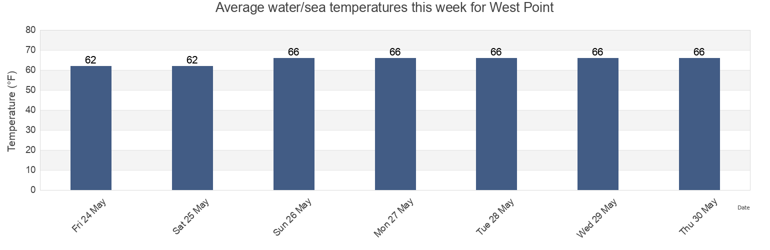
West Point water temperature
West Point water temperature for today, tomorrow and this week
More tide and marine information for West Point
Today's tides
Weekly tides
Weather
Fishing tides
Tide charts near West Point
Lord Delaware Bridge 100 yds. S of
Eltham Bridge 100 yds. north of
West Point 0.8 mile below
Goff Point 0.8 mile SSW of
Sweet Hall Landing
Roane Point
Poropotank Bay
Wakema (Fraziers Ferry Mattaponi River)
Wakema Mattaponi River
Powells Bluff 2.2 n.mi. NW of