EN
°F
Change your measurements
Meters
Feet
°C
°F
km/h
mph
kts
am/pm
24-hour
Your settings have been updated
Change your language
Deutsch
Español
Italiano
Nederlands
中文
English
Français
日本語
Português
Today
7 days
Weather
Fishing
Water temp
United States
tide charts
Virginia
tide charts
Mathews County
tide charts
New Point Comfort 2.0 n.mi. WSW of
tide chart
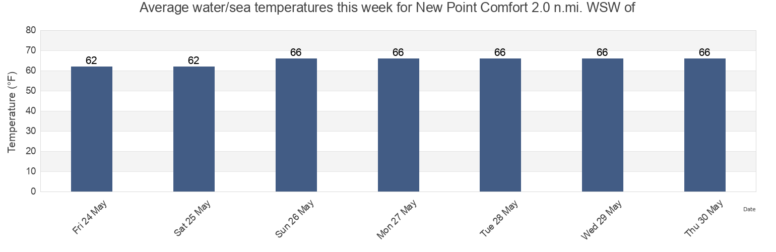
New Point Comfort 2.0 n.mi. WSW of water temperature
New Point Comfort 2.0 n.mi. WSW of water temperature for today, tomorrow and this week
More tide and marine information for New Point Comfort 2.0 n.mi. WSW of
Today's tides
Weekly tides
Weather
Fishing tides
Tide charts near New Point Comfort 2.0 n.mi. WSW of
Browns Bay
SW Branch, Severn River, Mobjack Bay
York River Ent. Channel (NW end)
Tue Marshes Light 0.7 n.mi. north of
Horn Harbor Marina
Tue Marshes Light
Mobjack (East River)
Ware River Point
Mobjack East River
Tue Marshes Light 0.9 n.mi. WNW of