EN
°F
Change your measurements
Meters
Feet
°C
°F
km/h
mph
kts
am/pm
24-hour
Your settings have been updated
Change your language
Deutsch
Español
Italiano
Nederlands
中文
English
Français
日本語
Português
Today
7 days
Weather
Fishing
Water temp
United States
tide charts
Virginia
tide charts
Accomack County
tide charts
Watts Island 4 miles south of
tide chart
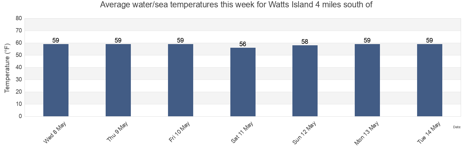
Watts Island 4 miles south of water temperature
Watts Island 4 miles south of water temperature for today, tomorrow and this week
More tide and marine information for Watts Island 4 miles south of
Today's tides
Weekly tides
Weather
Fishing tides
Tide charts near Watts Island 4 miles south of
Harborton Pungoteague Creek
Harborton (Pungoteague Creek)
Watts Island
Tangier Sound Light 0.5 n.mi. east of
Watts Island 2.3 n.mi. east of
Tangier Sound Light 1.5 miles NE of
Pocomoke Sound Approach
Milby Point 5.3 n.mi. WNW of
Chesconessex Creek Schooner Bay
Chesconessex Creek (Schooner Bay)