EN
°F
Change your measurements
Meters
Feet
°C
°F
km/h
mph
kts
am/pm
24-hour
Your settings have been updated
Change your language
Deutsch
Español
Italiano
Nederlands
中文
English
Français
日本語
Português
Today
7 days
Weather
Fishing
Water temp
United States
tide charts
Massachusetts
tide charts
Nantucket County
tide charts
Long Shoal-Norton Shoal
tide chart
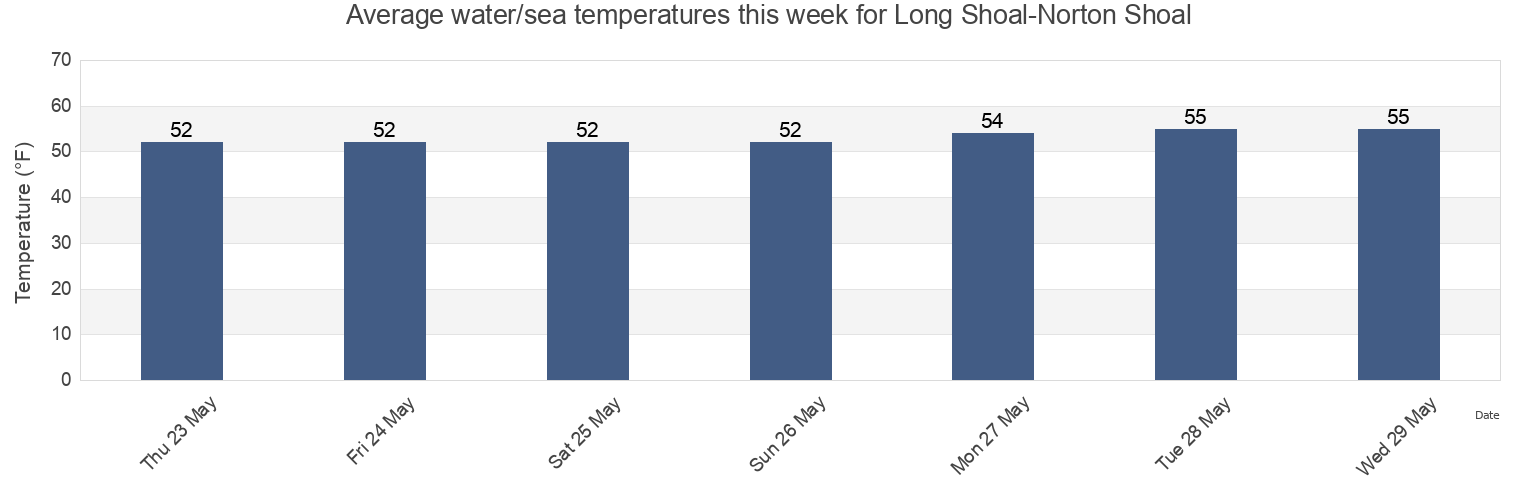
Long Shoal-Norton Shoal water temperature
Long Shoal-Norton Shoal water temperature for today, tomorrow and this week
More tide and marine information for Long Shoal-Norton Shoal
Today's tides
Weekly tides
Weather
Fishing tides
Tide charts near Long Shoal-Norton Shoal
Long Shoal-Norton Shoal between
Cross Rip Channel
Muskeget I. channel 1 mile northeast of
Cape Poge Lt. 3.2 miles northeast of
Cape Poge Lt. 1.7 miles SSE of
Muskeget Island (North Side)
Muskeget Island North Side
Muskeget Channel
Muskeget Rock 1.3 miles southwest of
Wasque Point (Chappaquiddick Island)