EN
°F
Change your measurements
Meters
Feet
°C
°F
km/h
mph
kts
am/pm
24-hour
Your settings have been updated
Change your language
Deutsch
Español
Italiano
Nederlands
中文
English
Français
日本語
Português
Today
7 days
Weather
Fishing
Water temp
United States
tide charts
Massachusetts
tide charts
Dukes County
tide charts
Penikese Island 0.8 mile northwest of
tide chart
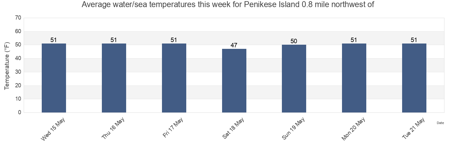
Penikese Island 0.8 mile northwest of water temperature
Penikese Island 0.8 mile northwest of water temperature for today, tomorrow and this week
More tide and marine information for Penikese Island 0.8 mile northwest of
Today's tides
Weekly tides
Weather
Fishing tides
Tide charts near Penikese Island 0.8 mile northwest of
Penikese Island
Penikese Island 0.2 mile south of
Gull I. and Nashawena I. between
Cuttyhunk Pond entrance
Cuttyhunk
Canapitsit Channel
Slocums River
Quick's Hole
Quicks Hole North side
Quicks Hole