×
Install our app
Add to homescreen
Tideschart web app
Get our offical app
EN
°F
Change your measurements
Meters
Feet
°C
°F
km/h
mph
kts
am/pm
24-hour
Your settings have been updated
Change your language
Deutsch
Español
Italiano
Nederlands
中文
English
Français
日本語
Português
Today
7 days
Weather
Fishing
Water temp
United States
tide charts
Maryland
tide charts
Somerset County
tide charts
Deal Island
tide chart
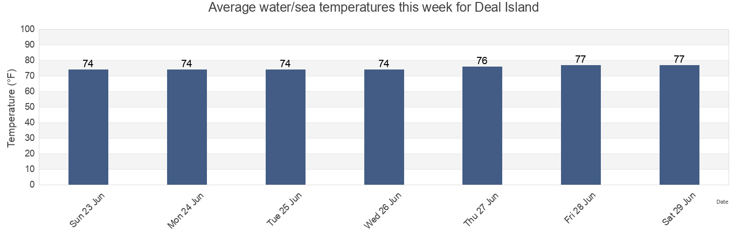
Deal Island water temperature
Deal Island water temperature for today, tomorrow and this week
More tide and marine information for Deal Island
Today's tides
Weekly tides
Weather
Fishing tides
Tide charts near Deal Island
Deal Is. 0.6 n.mi. W. of at Bouy 14
Chance
Manokin R. Ent. 1.1 n.mi. E of Drum Pt
Sharkfin Shoal Light
Frog Point 1.6 miles south of
Dames Quarter Creek
Long Point and Nanticoke Point between
Great Shoals Light (Monie Bay)
Great Shoals Light Monie Bay
Teague Creek Manokin River