EN
°F
Change your measurements
Meters
Feet
°C
°F
km/h
mph
kts
am/pm
24-hour
Your settings have been updated
Change your language
Deutsch
Español
Italiano
Nederlands
中文
English
Français
日本語
Português
Today
7 days
Weather
Fishing
Water temp
United States
tide charts
Maryland
tide charts
Calvert County
tide charts
Benedict highway bridge
tide chart
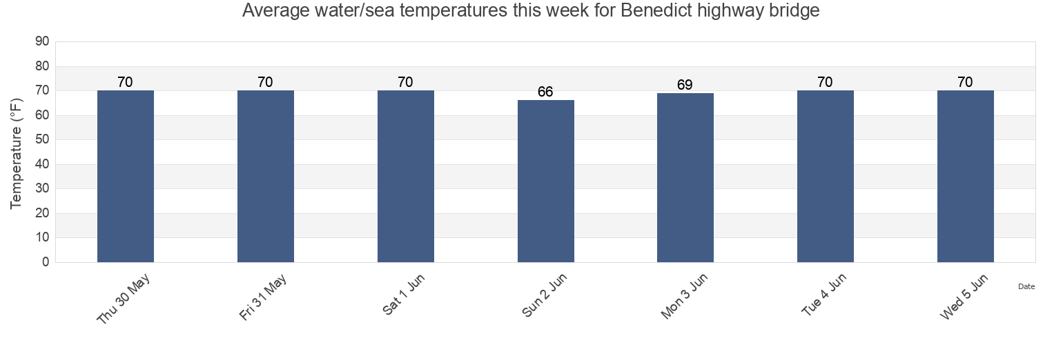
Benedict highway bridge water temperature
Benedict highway bridge water temperature for today, tomorrow and this week
More tide and marine information for Benedict highway bridge
Today's tides
Weekly tides
Weather
Fishing tides
Tide charts near Benedict highway bridge
Benedict
Sheridan Point 0.1 mile southwest of
Broomes Island
Lower Marlboro
Kenwood Beach 1.5 miles northeast of
Broomes Island 0.4 mile south of
Plum Point 1.4 miles ESE of
Peanuts
James Island 3.4 miles west of
Plum Point 2.1 n.mi. NNE of