EN
°F
Change your measurements
Meters
Feet
°C
°F
km/h
mph
kts
am/pm
24-hour
Your settings have been updated
Change your language
Deutsch
Español
Italiano
Nederlands
中文
English
Français
日本語
Português
Today
7 days
Weather
Fishing
Water temp
United States
tide charts
Delaware
tide charts
Kent County
tide charts
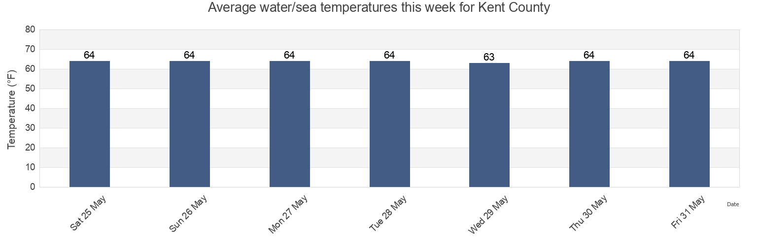
Kent County water temperature
Kent County water temperature for today, tomorrow and this week
More tide and marine information for Kent County
Today's tides
Weekly tides
Weather
Fishing tides
Regions and cities in Kent County, Delaware, United States
Ben Davis Point 0.8 mile southwest of
Elbow Bay
Milford (Mispillion River Entrance)
Ben Davis Point 3.2 n.mi. SW of
Frederica (Bowers Murderkill River Entrance)
Mispillion River mouth
Ben Davis Pt. Shoal southwest of
Heavens
Murderkill River entrance Bay
Big Stone Beach
Kelly Island 1.5 miles east of
Pickering Beach
Big Stone Beach 2.2 n.mi. ENE of
Kitts Hummock
Port Mahon
Big Stone Beach 2.8 miles southeast of
Leipsic (Leipsic River)
Ship John Shoal
Show more locations
Bombay Hook
Leipsic Leipsic River
Slaughter Beach
Bowers Beach
Leipsic River entrance
St. Jones River ent. 1 mile east of
Brandywine Range at Miah Maull Range
Mahon River Entrance
St. Jones River entrance
Cohansey River 0.5 mile above entrance
Miah Maull Range at Cross Ledge Range
Woodland Beach
Dover
Miah Maull Shoal Light
Woodland Beach Del.
Tide charts near Kent County
Dover
Heavens
Kitts Hummock
Pickering Beach
Bowers Beach
St. Jones River entrance
Frederica (Bowers Murderkill River Entrance)
Murderkill River entrance Bay
St. Jones River ent. 1 mile east of
Mahon River Entrance