EN
°F
Change your measurements
Meters
Feet
°C
°F
km/h
mph
kts
am/pm
24-hour
Your settings have been updated
Change your language
Deutsch
Español
Italiano
Nederlands
中文
English
Français
日本語
Português
Today
7 days
Weather
Fishing
Water temp
United States
tide charts
Connecticut
tide charts
Fairfield County
tide charts
Crane Neck Point 3.4 miles WNW of
tide chart
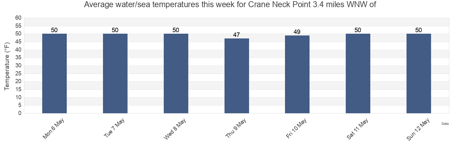
Crane Neck Point 3.4 miles WNW of water temperature
Crane Neck Point 3.4 miles WNW of water temperature for today, tomorrow and this week
More tide and marine information for Crane Neck Point 3.4 miles WNW of
Today's tides
Weekly tides
Weather
Fishing tides
Tide charts near Crane Neck Point 3.4 miles WNW of
Crane Neck Point 3.7 miles WSW of
Shoal Point 6 miles south of
Smithtown Bay
Crane Neck Point 0.5 mile northwest of
Old Field Point 2.9 n.mi. NNW of
Nissequogue River entrance
Eatons Neck 2.5 miles east of
Conscience Bay entrance (Narrows), Long Island Sound
Stony Brook Harbor
Stony Brook