City and County of San Francisco tide charts for today, tomorrow and this week

City and County of San Francisco, California, United States tide chart

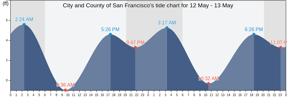
Thursday 18 April 2024, 7:26PM PDT (GMT -0700). The tide is currently rising in City and County of San Francisco. As you can see on the tide chart, the highest tide of 4.92ft will be at 10:09pm and the lowest tide of 0.33ft was at 3:06pm. Click here to see City and County of San Francisco tide chart for the week.

Next high tide

Next high tide is at
10:09pm

Next low tide

Next low tide is at
3:44am

Tide times for City and County of San Francisco

Tide table for City and County of San Francisco this week
Day Tide times for City and County of San Francisco Sunrise and sunset
1st Tide 2nd Tide 3rd Tide 4th Tide
Thu 182:58am
2.3 ft
8:33am
4.59 ft
3:06pm
0.33 ft
10:09pm
4.92 ft
6:29am 7:49pm
Fri 193:44am
1.64 ft
9:33am
4.59 ft
3:44pm
0.66 ft
10:35pm
5.25 ft
6:28am 7:50pm
Sat 204:23am
1.31 ft
10:25am
4.59 ft
4:17pm
0.98 ft
10:57pm
5.25 ft
6:27am 7:51pm
Sun 214:58am
0.98 ft
11:12am
4.59 ft
4:47pm
1.31 ft
11:18pm
5.25 ft
6:25am 7:52pm
Mon 225:31am
0.33 ft
11:58am
4.59 ft
5:16pm
1.64 ft
11:39pm
5.58 ft
6:24am 7:53pm
Tue 236:03am
0 ft
12:42pm
4.27 ft
5:45pm
1.97 ft
6:23am 7:54pm
Wed 2412:03am
5.58 ft
6:35am
-0.33 ft
1:28pm
4.27 ft
6:14pm
2.3 ft
6:21am 7:55pm

Best fishing times for City and County of San Francisco today Today is an average fishing day

Major fishing times

From 2:07pm to 4:07pm

Lunar Transit (moon up)

Minor fishing times

From 3:49am to 4:49am

Moonset

From 2:37pm to 3:37pm

Moonrise

Click here to see City and County of San Francisco fishing times for the week.

Current weather in City and County of San Francisco

Partly cloudy

Weather

Cloud cover 50%
Temperature

Temperature

55°F
Min 52°F/Max 60°F
Wind

Wind

8 mph
Wind gust 14 mph
Humidity

Humidity

81%
Dew point 50°F

Click here to see City and County of San Francisco weather for the week.

Today's weather in City and County of San Francisco

The sun rose at 6:29am and the sunset will be at 7:49pm. There will be 13 hours and 20 minutes of sun and the average temperature is 56°F. At the moment water temperature is 51°F and the average water temperature is 51°F.

Weather forecast for City and County of San Francisco today
0 h 3 h 6 h 9 h 12 h 15 h 18 h 21 h 24 h
Partly cloudyPartly cloudyPartly cloudyPartly cloudyPartly cloudyPartly cloudyPartly cloudyPartly cloudyPartly cloudy
53°F58°F55°F58°F60°F58°F55°F54°F53°F

Click here to see City and County of San Francisco weather for the week.

More tide and marine information for City and County of San Francisco

Regions and cities in City and County of San Francisco, California, United States

2nd StreetNorth Point Pier 35 north ofPoint San Pablo midchannel
Alameda Estuary southeast endNorthridge ParkPoint San Pedro
Alameda Naval Air StationOakland (Matson Wharf)Point San Pedro 0.55 nmi. SE of
Alameda Radar Tower 0.9 nmi. SSW ofOakland 7th St. Marine 0.6 nmi. SSW ofPoint San Quentin
Alcatraz (North Point)Oakland AirportPoint San Quentin 0.82 nmi. east of
Alcatraz IslandOakland Airport southwest ofPoint San Quentin 1.3 nmi. east of
Alcatraz Island .8 mi EOakland Airport SWPoint San Quentin 1.9 mi E
Alcatraz Island 0.2 mile west ofOakland Berth 67Point San Quentin 1.9 miles east of
Alcatraz Island 0.5 mile north ofOakland Harbor (Grove Street)Point Simpson Angel I. 1.05 nmi. E of
Alcatraz Island south ofOakland Harbor (Park Street Bridge)Potrero Point
Alcatraz Island southwest ofOakland Harbor Grove StreetPotrero Point 1.08 nmi. east of
Alcatraz Island WOakland Harbor High Street BridgePotrero Point 1.1 mi E
Angel Island .8 mi EOakland Harbor Park Street BridgePotrero Point 2 miles east of
Angel Island (East Garrison)Oakland Harbor Webster StreetPt. Blunt Angel I. 0.25 nmi. east of
Angel Island (west Side)Oakland Harbor WebStreeter StreetPt. Blunt Angel I. 0.8 mi. SE of
Angel Island 0.75 mile east ofOakland Inner HarborRaccoon Strait
Angel Island East GarrisonOakland Inner Harbor ChannelRaccoon Strait off Hospital Cove
Angel Island off Quarry PointOakland Inner Harbor ReachRaccoon Strait off Point Stuart
Aquatic ParkOakland Matson WharfRed Rock .1 E
Baker BeachOakland Middle HarborRed Rock 0.60 nmi. NNE of
Baker Beach (South Bay) 0.3 nmi. NW ofOakland Outer Harbor Entrance LB 3Red Rock east of
Baker s BeachOakland PierRichardson Bay Entrance
Bay Bridge Pier DOakland Yerba Buena IslandRichmond Inner Harbor
Bay Bridge Span B-COcean BeachRincon Point
Berkeley Yacht HarborOcean Beach (Outer Coast)Rincon Point midbay
Berkeley Yacht Harbor .9 mi SOcean Beach Outer CoastRoberts Landing (1.3 Miles West Of)
BlackiesOyster Point 2.8 miles east ofRoberts Landing 1.3 Miles West Of
Bluff Point .1 mi EOyster Point MarinaRockaway Beach
Bluff Point 0.1 mile east ofPacifica State BeachSachuest Beach (2nd Beach)
Bluff Point 1.15 nmi. east ofPalisades ParkSan Francisco
Brooklyn BasinPier 23San Francisco (Golden Gate)
Candlestick PointPinole PointSan Francisco (North Point Pier 41)
Carquinez Bridge I-80Pinole Point 1.18 nmi. west ofSan Francisco Bar
Chevron Oil Company Pier RichmondPinole Point 1.2 mi WSan Francisco Bar north of ship channel
China BeachPinole Point 1.27 nmi. NNW ofSan Francisco Bay Entrance (Golden Gate)
Corte Madera CreekPinole Point 1.42 nmi. NNW ofSan Francisco Bay Entrance (Outside)
Coyote Point 2.3 nmi. NNE ofPinole Point 3.0 nmi. WNW ofSan Francisco North Point Pier 41
Crown Memorial State BeachPinole Point San Pablo BaySan Francisco southern traffic lane N end
Davis Point (midchannel)Pinole ShoalSan Francisco traffic separation zone buoy
Davis Point 1.0 nmi. NW ofPoint AdamsSan Leandro Channel
Emeryville MarinaPoint Avisadero .3 mi ESan Leandro Channel (San Leandro Bay)
Fleming Point 1.7 mi SWPoint Avisadero 0.3 mile east ofSan Leandro Channel San Leandro Bay
Fleming Point 1.72 nmi. SW ofPoint Avisadero 0.6 nmi. ESE ofSan Leandro Marina
Fort Cronkite Rodeo BeachPoint Avisadero 1 mi ESausalito
Fort Funston BeachPoint Avisadero 1 mile east ofSausalito (Corps Of Engineers Dock)
Fort Point 0.3 nmi. west ofPoint Avisadero 1.25 nmi. SSE ofSausalito Corps Of Engineers Dock
Fort Point 0.5 nmi. east ofPoint Avisadero 2 mi ESeaplane Harbor
Golden Gate Bridge .8 mi E .Point Avisadero 2 miles east ofSelby
Golden Gate Bridge 0.46 nm E ofPoint Blunt .3 mi SSharp Park
Golden Gate Bridge 0.8 mile east ofPoint Blunt .8 mi SESierra Point 1.2 nmi. east of
Golden Gate Bridge 0.88 nm NE ofPoint Blunt Angel I. 0.25 mile S ofSierra Point 1.3 mi ENE
Golden Gate East BeachPoint Blunt Angel I. 0.5 nmi. SW ofSierra Point 1.3 miles ENE of
HerculesPoint Bonita (Bonita Cove)Sierra Point 4.4 mi E
Hercules (Refugio Landing)Point Bonita 0.8 nmi. NE ofSierra Point 4.4 miles east of
Hercules Refugio LandingPoint Bonita 0.95 nm SSE ofSouth Bay
Hunters PointPoint Bonita Bonita CoveSouth Channel
Hunters Point 1.6nm SE ofPoint Bonita Lt. 0.4 nmi. SSE ofSouthampton Shoal Channel LB 6
Jap RockPoint Bonita Lt. 5.27 nmi. WSW ofSouthampton Shoal Light .2 mi E
Lands End BeachPoint Cavallo 1.3 mi ESouthampton Shoal Light 0.2 mile E of
Leconte BayPoint Cavallo 1.3 miles east ofThe Strait
Little Coyote Pt 3.4 mi NNEPoint ChaunceyTreasure Island .3 mi E
Little Coyote Pt. 3.4 nmi. NNE ofPoint Chauncey 0.75 nmi. NW ofTreasure Island .5 mi N
Long View ParkPoint Chauncey 1.25 nm north ofTreasure Island 0.2 mile west of
Mare IslandPoint Chauncey 1.3 miles east ofTreasure Island 0.3 mile east of
Mare Island Strait (Buoy 4)Point Diablo 0.2 mile SE ofTreasure Island 0.5 mile north of
Mare Island Strait EntrancePoint IsabelTreasure Island 0.78 NM NW of
Mare Island Strait NE of Pier 34Point LobosTreasure Island 0.8 mile west of
Marin CountyPoint Lobos 1.3 nmi. SW ofTreasure Island 0.85 nmi. east of
Mile Rock beachPoint Lobos 3.73 nmi. W ofWilson Point 3.9 mi NNW
Mile Rock Lt. 0.2 nmi. NW ofPoint Lobos 5.47 nmi. SW ofWilson Point 3.90 nmi. NNW of
Mission Rock 0.6 mile east ofPoint OrientYellow Bluff .8 mi E
Mission Rock 1.3 mile east ofPoint PinoleYellow Bluff 0.8 mile east of
Mission Rock 2.0 miles east ofPoint Richmond .5 mi WYerba Buena Island
Mount Tamalpais State ParkPoint Richmond 0.5 mile west ofYerba Buena Island 0.3 nmi. SE of
Mulford Gardens Channel ApproachPoint Richmond 0.8 nmi. NNW ofYerba Buena Island W of
Mussel Rock ParkPoint San BrunoYerba Buena Island west of (midchannel)
North PointPoint San Bruno 0.51 nmi. east of

Popular locations in City and County of San Francisco

Ocean Beach (Outer Coast)San FranciscoSan Francisco (Golden Gate)